The Hinky Dink Railroad (aka The Westville Cut-Off)
The Hinks, The Gully, What Is It?
From 1924 to 1941, airplane pilot, Victor Dallin operated an aerial photography company. At first he flew out the Clementon NJ airport ( yes there was an airport in Clementon), but later from Philadelphia.. He took thousands of high resolution aerial photographs many of which are of the Philadelphia/South Jersey area. They are view-able online (link here)
The Dallin Aerial Surveys are an invaluable resource for historians. A time machine for the eyes. A portal to what once was. It's fascinating to be able to view what existed around you 80-90 years ago and how things have changed.
 |
| Camden NJ 1931 - click to enlarge |
|
It was while viewing some 1927 photos of the Brooklawn/Gloucester City, NJ area, that I noticed something I could not explain. What appeared to be railroad tracks curving east off the West Jersey and Seashore Line that ran from Camden to Woodbury and points south. Zooming in I could see a long row of box cars,a switching tower and and an elevated line complete with bridges that extend at least to the Black Horse Pike and possibly beyond
 |
| Brooklawn NJ 1927 |
Here was a mystery of history and an investigation I needed to pursue. Although I am not a so called "train enthusiast", I knew that no such railroad line existed during my 60 plus years of existence. I needed to answer the questions of what? when? where? and why? Time to put my detective hat on.
 |
| WHAT THE FRICK? |
First I looked at some old maps, but no luck here as this line did not appear.
 |
| 1920(thanks to SJRail.com) |
Next thing I tried was current satellite photos as I knew that abandon railroad rights of way sometimes can be traced from the air. Here I hit pay dirt. The remnants of what I could see in the 1927 photo were still very apparent today! What I could see was a five mile scar that ran east/west across Camden County. I had passed it hundreds of times and really never gave a second thought to what it was or why it was there. Some areas I thought were rights of way for utility lines and other areas, possibly old creek beds? Now I could see from the air that this was one continuous feature that extended from Broadway in Brooklawn to Haddon Ave near Grove Street in Haddonfield. If it was a rail line, what happened to it?
 |
| The Remnants Of This Railroad Is Still Very Much Visible From The Air |
I next asked a few friends, who are longtime residents of the western portion of the this area. They were not familiar with any railroad but did have a name for the elevated dirt piles that I observed in the photo and once supported the track. They called it the "Hinks" or the "Hinky Dinks" For decades children from Gloucester City, Brooklawn, Bellmawr, Mt Ephraim and West Collingswood Heights would play and ride bikes on these mounds and use them as an off road short-cut, especially to the Black Horse Pike Shopping Center area. Other friends from the eastern section that border Oaklyn, Audubon and Haddon Township had always assumed that what they called "the Gully" was a natural feature or a creek or stream.
 |
| Off Crystal Lake Ave |
Now armed with some new info, I returned to Google and did some searches of the terms 'Hinks". "Hinky Dinks" "Gully" and "railroad and finally found the answers I had been looking for.
 |
| thanks to SJRail.com |
What I had discovered was "The Westville Cut-Off", an abandon railroad line that was built in 1906-08, but was never completed. A brainchild of the West Jersey Seashore branch of the Pennsylvania Railroad, who a few years earlier built the Delair Railroad bridge over the Delaware River which created increase rail traffic in South Jersey and especially into Camden. The Westville Cut-Off would have created a by-pass around congested Camden for rail traffic to Woodbury, Vineland, Salem, Bridgeton, Millville and Cape May
 |
| Delair Delaware River Railroad Bridge |
Online I was able to find some limited information about the cut-off and I need to thanks all those railroad historians who have done such a great job documenting the heritage of our once great rail lines. Here are some links to additional information - (link) (link) (link)
Construction began in the spring of 1906. This line would not have any grade crossings, meaning that several bridges would have to be built so roads could either go under or over the tracks. On the western end the track were elevated on mounts of soil (The Hinks) and iron bridges were constructed over the Little Timber Creek, Market St and Park Ave in Gloucester and also over the tracks of the Glenloch Branch of the Reading Railroad ( where Klemm Ave is today ). A land bridge was constructed over the south branch of the Newton Creek with a culvert below.
 |
| The Track Was To Go Under Nicholson Road |
 |
| 1927 - Click to Enlarge |
On the eastern end the tracks were to go below grade, so a cut or ditch was dug ( The Gully ). The excavation began just north of Nicholson Rd. A culvert was constructed at Peters Creek and bridges over the line were installed at Newton (East Atlantic) Ave., the parallel Reading Railroad line in Oaklyn and over the White Horse Pike just north of Nicholson Rd. It's unclear whether other bridges were ever constructed They were planned at least at Merchant Ave at Haviland in Audubon, Crystal Lake and West End Ave. The gully was dug to about Crystal Lake Ave and it still exist today.
 |
| The Beginning of the "Gully" off Nicholson Rd |
 |
| Land Bridge Over Peter's Creek, Oaklyn NJ |
 |
| Peter's Creek Culvert |
 |
| View of the Gully from Manor /West Atlantic Ave , Oaklyn, NJ |
 |
| Bridge over Gully at Newton/East Atlantic Ave(left) and a bridge for the Reading Railroad |
 |
| Construction Photo & Current Aerial View - Oaklyn |
 |
| The White Horse Pike over the Gully |
 |
| October 1906 Courier Post Gloucester Article |
 |
| July 1907 | |
 |
| October 1907 | | | | | | |
By December of 1908, all construction ceased when the railroads found themselves short on cash because of the financial Panic of 1907. In 1912 the Pennsylvania Railroad considered finishing the line but railroad infrastructure improvements through Camden had made the need for the cut-off a expensive gamble. It was never completed.
 |
The
Cut-Off effectively cutoff an undeveloped section of Audubon from the
rest of town. E Merchant & Haviland Aves came to dead ends at the
gully. A real estate developer had a Roebling steel suspension bridge built over the gully in 1912 so new residents could walk to town and the train/trolley stations. The bridge was demolished in 1942 for scrap metal needed during World War II
|
 |
| May 1911 |
Although never used as a railroad, the cut-off found other uses. The Pennsylvania Railroad installed utility lines in order to transmit cheaper Philadelphia Electric Co power for their electric West Jersey Seashore Lines. About a mile of track and a siding where laid between Broadway and Market St in Gloucester City.. This track was used to store idle freight cars for the Campbell Soup Co and probably other companies.
 |
| December 1913 | |
 |
| 1923 | |
 |
| The Switch Tower near Brooklawn |
 |
1927
|
 |
| PSE&G Gas Line |
Traces of the Westville Cut-Off still remain. The elevated metal bridges and storage tracks were dismantled during World War II for scrap drives. The concrete bases of the Little Timber Creek and Grenloch Branch bridges still remain, as do he culverts and land bridges over the Newton Creek and Peters Creek. So do the iron bridges over the gully in Oaklyn.
 |
| Little Timber Creek Bridge Bases |
 |
| West Jersey Railroad Electric Tower Base | | | | | | | | | | | |
 |
| Base of Electric Line Towers |
 |
| Bridge Bases at Grenloch Branch RR on Klemm Ave |
 |
| Bridge at Park Ave Completely Gone as are the Hinks |
 |
| Land Bridge and Culvert At the Newton Creek |
 |
The Newton Creek Tunnel aka "Devils Hole"
|
The low lying gully has become a collection point
for runoff water and and tributary like streams and marshlands for nearby
natural waterways like Peters Creek and the Newton Creek adjacent to Saddlers
Woods in Westmont. In fact if you ask most residents who live adjacent to the
gully they will tell you it is a natural waterway and have no idea that it was
man made..
The elevated mound of dirt, the Hinks were gradually
removed and only a small portion still exist off Pennsylvania Ave in West
Collingswood Heights. The railroads steel girder power towers where removed
about 30 years ago, but their concrete bases can still be found all along the
route..
 |
| The Last Remaining Dirt Mounds - The Hinks |
Narrow gauge track can also be found in the gully. This track was used for construction and excavation equipment and was never intended for freight traffic. Much of the track has been obscured by soil and vegetation, but they sometimes surface as a result of erosion and the shifting stream at the bottom of the gully. It is said to be the last narrow gauge track in South Jersey
 |
| Remnants of Track East of the White Horse Pike |
One of most lasting and apparent remnant of the cut-off
is that mysterious unused strip of grass that has always divided the Black
Horse Pike Shopping Center. In the 1950's the Penn Fruit Co opened their iconic
architectural marvel at the corner of the Pike and Nicholson Rd, and a few
years later the adjacent Korvette/Penney outdoor mall opened. Over the years
this shopping center has changed, has been demolished and rebuilt, and has been
renamed and redesigned. The one thing that has barely changed is that strip of
grass that cuts off the two sections. The stores have never encroached and there was even a time when the owner, PSE&G,
prohibited traffic between the two sides of the shopping center by installing a
fence. It was eventually removed.. Recently PSE&G allowed a small parking
lot for the employees at the Chick Fil A and the Sonic restaurants to be built
on this right-of way..
 |
| The Strip - Black Horse Pike Shopping Center |
 |
| The Strip - Black Horse Pike Shopping Center | | |
 |
| Penn Fruit Supermarket Audubon 1950's |
One of most lasting unanswered questions surrounding the Westville Cut-Off is the origin of the term "Hinks" or "Hinky Dinks". Over the years that question has been raised many times, but has never been answered. I know this term goes back at least 60 years and possibly almost a hundred and it's beginnings might be lost to history. Here's my take:
Dinky is a railroad term for a short line railroad, a word that may of
come from another railroad term "dinkey" which is a small locomotive
that was used to move cars around a railroad yard, or an industrial or
construction site. Perhaps such a small locomotive was used at the
western end of this line where freight cars were stored or during the
the construction of the elevated portion. "Hinky" is defined as something that it not quite right, out of place, or unreliable. My guess is that as the mounds went unused and seemed to have no purpose the dirt piles indeed seemed out of place or hinky. So this Dinky of a railroad probably became Hinky over time. Thus the Hinky Dink


Fantastic article. Lots of work put into this. Thank you!
ReplyDeleteWonderful article. Being from a freight conductor's family, I enjoyed the history. Thank you!
ReplyDeleteI grew up in Oaklyn, walking through the Gully every Saturday to spend my dollar at the Audubon Shopping Center. Fascinating read! Thank you for the time put into this study and for sharing your research. Great job!
ReplyDeleteGreat article. The Hinks were my playground in the 50s. Primarily the stretch between Park Ave and the Black horse Pike.
ReplyDeleteFYI....Devils Hole got its name because the earth on top of the culvert would seep through, and you could look straight down to the dark water below. It was very scary to us kids.
I also got to witness the dynamiting of the bridge supports on Park Ave.VERY EXCITING !!
Greetings, where is/was the Devil's Hole located?
DeleteMy father said the devils hole was at the Newton Creek crossing where the cement factory is now (behind Starlight).
DeleteFantastic! Makes me hearken back to my own childhood playing in the gully in Audubon. I once hiked it all the way from Peter's Creek to the Green Valley Farms, and came up for some ice cream (a Clownie sundae,of course). In those days, Paul VI and Westmont Plaza and Haddon Twp.'s football field were all just Jarvis's farm.
ReplyDeleteGreat article-triggered lots of memories.
ReplyDeleteI lived at 100 Congress Ave-the corner of Congress Ave and Manor Ave in Oaklyn from about 1972-73 to 1978. I was 10 when we moved. Our property bordered "that" Gully. I remember being in the Gully as much as being anywhere else. I remember walking the Gully to J.C. Penny's and Korvettes. I think I remember heavy rains would cause washouts exposing buried train tracks. Good stuff.
This comment has been removed by the author.
ReplyDeleteGreat article. My mother's house sits next to the gully in Audubon. My grandparents bought the house in 1939. Spent many a day in the gully as a child.
ReplyDeleteGreat article. My mother's house sits next to the gully in Audubon. My grandparents bought the house in 1939. Spent many a day in the gully as a child.
ReplyDeleteWonderful article! I grew up in Haddon Heights and ever since a small child always wondered about this out of place landscape only thinking it was "the world around me". I too thought is natural runoff and never realized it was all connected. The gully behind Paul VI etc. Fascinating!!!
ReplyDeleteThanks for your investigative work. The Hinks were our playground as kids growing up on Park Ave in Gloucester and at Cloverdale Farm.
ReplyDeletei remember riding my bike from Gloucester to the hinky dinks to play and ride the hills. i haven't heard that term in a very long time.
ReplyDeleteAmazing info, thank you
ReplyDeleteFabulous article & PICS, THANK You.
ReplyDeleteFabulous article & PICS, THANK You.
ReplyDeleteI grew up playing on the Hinks off BHP in the sixties. In the 70s we called the concrerte tresle base on the grass strip "the Monument and used it ass a meeting spot behind the shopping center. My grandfather told me they were called the Hinky Dinks when he was a child in the 10s and 20s, so the WWII speculation is off by a few years. Great article. Thanks.
ReplyDeleteYou're not the first person to relate the term pre-dates WWII. I edited my speculation. Thx
DeleteBut then again my grandfather swore he saw it rain frogs and tadpoles when he was a kid, and got extremey disturbed if you doubted it. I believed him. :)
DeleteI have seen it "rain frogs" on our way to my Uncle's house in the Poconos!
DeleteGreat article. In Audubon where they still refer to it as the gully, you can see pylons for a swinging bridge that was built over the gully so kids could get to the Haviland Ave school... during WW2 (I believe) the bridge was taken out and melted down for the war effort... Audubon's historical society has photos and better information on this portion of the line.
ReplyDeleteInteresting and cool look back at the history of "the Gully". We lived on Graisbury Ave. in Haddon Township, used the Gully as a short cut to HTHS, esp. when coming home in afternoon. Somehow we knew it had been dug for a traintrack (perhaps my Dad learned this when we moved there in 1963). We had great adventures tramping thru the Gully and in and out of Saddler's Woods. Thanks for a happy trip down memory lane!
ReplyDeleteWhen they first put up the shopping center on Nicholson Rd, we would cut through the Gully from Oaklyn to get to Woolworth's. The Farmer on the Audubon Park side would come out to chase us away from his property. He always seemed to be waiting for us!
ReplyDeleteThe Oaklyn Cougars practiced in the gully just off of Nicholson rd. You had better be doing laps when Holy Maternity's 6 o'clock bells rang!
ReplyDeleteThe Oaklyn Cougars practiced in the gully just off of Nicholson rd. You had better be doing laps when Holy Maternity's 6 o'clock bells rang!
ReplyDeleteReally neat to read....I grew up in Mt Ephraim, West Colls Heights and Oaklyn....spent many a day in and sround the Gully and the Hinks. Harvey Hans
ReplyDeleteI walked to Gloucester High from Brooklawn 1961-1965 along the right of way after crossing Little Timber Creek on railroad tracks we called the "trestle". Parents resisted the route as dangerous, but I think most kids from the west side of Brooklawn went that way. Great research!
ReplyDeleteI walked to Gloucester High from Brooklawn 1961-1965 along the right of way after crossing Little Timber Creek on railroad tracks we called the "trestle". Parents resisted the route as dangerous, but I think most kids from the west side of Brooklawn went that way. Great research!
ReplyDeleteWow! The Brooklawn tressle was right behind my house. I used to swim there in the summer. Always wondered why they were there. Also, saw the cement base of the previous steel tower that I presumed was just the forerunner to the present high tension towers. I also rode my bike to the Audubon shopping center through the cut through. I walked to Gloucester High along the dirt road. My buddy crashed his '58 Chevy convertible into the gully off of Nicholson Rd. with 4 guys in the car. Lucky nobody was killed. Saw various parts of the Hinks along Newton Creek in Oaklyn and never knew what they were. Thanks for the great story!!
ReplyDeleteI never knew any of this! I "cut the gully" at the area of Van Sciver School to get to Haddon Twp. High pretty much daily from grades 7-12. Thanks for the information.
ReplyDeleteI don't mind when people use my photos but I find it kinda rude when they don't ask and purposely remove the watermark from them. Just ask next time... With that being said, it was a very good write up on the Cut-Off. One theory as to why some rails remain in the gully is that prior to the dismantling of the tracks, a large washout covered that section with mud and it wasn't worth excavating for the minimal amount of steel rail to be recovered.
ReplyDeletesorry, removed your photo. Found your photo from a google search. Did not purposely remove watermark. The screen capture I used did not get all of the photo.
DeleteThank you so much! As a kid, those bridge bases over Klemm (Station) Ave. confused the heck out of me as I always had the suspicion it was a train bridge. I always felt that the clearing through the BHP shopping center and by the cement factory was a train clearing as well as the gully, but it made no sense that a train would ever be routed that way. You have put closure to my life in a sense.
ReplyDeleteFantastic research . Lived here 15 years always new about this unfinished oddity but your great work has answered a lot of this mystery had no idea so much of it was started and abandoned. Some of these places may have been visited by Steven king as a kid so similar to It.
ReplyDeleteThank you for this article, as a child I used to walk the Hinky Dinks many times from Audubon Park to Gloucester City to visit my grandparents.Growing up in the 60's and living in Audubon Park everyone knew of the Hinky Dinks.I never knew the history and often wondered how it got its name.This was so interesting.T hanks for sharing!
ReplyDeleteGrew up on park Ave in the 60's....
ReplyDeleteSteve,teddy,Bill M.,Bill L.& Steve P.
Lots of fun on the hunky dinks....learn alot there
Really enjoyed reading about our Hinky Dinks. We grew up on Cloverdale Ranch with the Hinks practically in our back yard. The ranch was located just off Park Ave, near the elevated bridge. In one of your photos I can see Millers Pond that also backed up to our ranch. As far back as I can remember, we all knew those hills as The Hinky Dinks, now I know their history. Cloverdale Ranch was an anomaly in Gloucester City, with horses, cows, chickens, the works. I see a posting in 2016 from my cousin Thomas Young. He and I spent many a Saturday afternoon climbing the Hinks! Thanks for the article.
ReplyDeleteRuss Bee
Grew up on Payson Ave off Nicholson in the '60s & '70s. Lots to do down at the Gully. Tadpole Island, sledding, riding bikes & then mini-bikes. Once set off a pretty large grass fire accidently behind the Holy Maternity church. There was a time they dumped leaves over the cliff, in the outfield of the church ballfield, into the Gulley. We'd jump off the top, landing 20' below, in the piles of leaves on the bottom. Sure beat sitting in front of a computer playing video games.
ReplyDeleteI honestly believe they use that swath of land as an approach to PHL airport. Many days the planes would fly one after the other directly over the Gulley.
Thanks for a great article.
Thanks for a great article. BUT Please give my site credit (with a link to the sites home page-> http://www.sjrail.com/wiki/index.php?title=Main_Page ) for the map that I made. And fix your link to my page-> http://www.sjrail.com/wiki/index.php?title=West_Jersey_and_Seashore_Railroad#The_Westville_Cutoff
ReplyDeleteThanks
Good article. I fondly recall playing on the Hinky Dinks as a child with my eight siblings. My parents were Harry and Honey Williams of 941 Hudson St. I always wondered about the name.
ReplyDeleteAn impressive piece of work!
ReplyDeleteThe Gully was my playground off Davis Ave., Audubon. I knew the train tracks were there since day one. Between the tracks were always great for collecting water exposing many tadpoles. We played "war" down there quite often. We even used it as a sledding hill during snow storms. Great story that brought back many childhood experiences. Nice Job!
ReplyDeleteMany thanks for article & pixs. In the early 60's we'd walk from Klem ave., (behind Starlight) to E.J.Korvetts via the Hinks. We swam in "Devils Hole", sneaked into the Drive-in & watched movies via the Hinks. Someone mentioned a Cloverdale ranch with horses. Thinking back, I recall horseback riders many times. Not sure of their exact names, maybe "Bumpy" Warden, Sandy Conte. Again, not exactly sure of names, but they would always stop and answer our questions about horses. It seemed that it was always an adventure. It's to bad that there was never any interest in making a "rails-to-trails bike path from Brooklawn to Audubon or further.
ReplyDeleteBack in the sixties we would ride our bikes from Brooklawn to Audubon Shopping Center(Korvettes) using this route.
ReplyDeleteI never knew the history.
Fascinating
What a great article..Like putting all these puzzle pieces of our past together, growing up in western Camden County.. Now I know why the trail to GHS was separated and elevated a bit from the woods.. Park Ave concrete bases.. and why the dirt mounds and Devil's Hole existed.. the cutoff at Audubon SC.. the Gully.. etc etc.. all for one reason.. awesome
ReplyDeleteGreat article. I lived on Golden Avenue in West Collingswood Heights in the early to mid 1980's. We had a large back yard and there were woods behind the back yard that belonged to the railroad. Grant Avenue dead-ended after a few houses; now it still dead-ends but goes back farther where the woods were and there a few newer homes back there now. I also seem to recall that there was a railroad crossing on the Black Horse Pike near the Swim Mor pools. As a matter of fact, back then I don't know if Main Street was there or not (there was no traffic light there back then). I don't remember any trains going through there, but I do remember the tracks crossing the BHP. Does anybody else remember these railroad tracks? My dad grew up in the same house and I remember him telling my brother and I about playing in "The Hinks" as a kid. I also remember my brother and I always wondering what was down in the Gully; never knew it was man-made. My parents would always honk the horn going through that narrow overpass right next to the Gully. Dad is long gone now but I still honk the horn for him when I drive past the Gully!
ReplyDeleteabout 1990, I pulled a narrow-gauge rail section about 25' out of the gully in Audubon and laid it as a garden boarder in my front yard when i lived on Bell Road in Mt. Ephraim. When i moved, i gave it to a friend in Audubon who did something similar with it in his yard.
ReplyDeleteOh wow, I moved to Bell Road two years ago. There's a railroad section here behind the garage and got excited that it might be yours, but then I read that you moved.
DeleteAlways cut through the hanky dinks going to Audubon shopping center. This was great to know
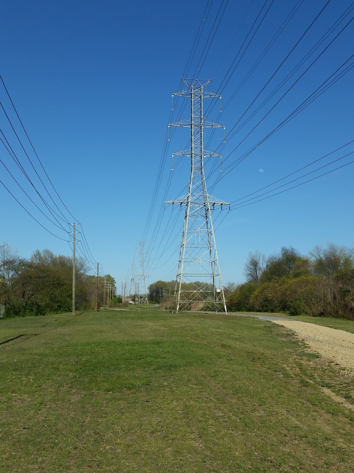
ReplyDeleteHad you contacted the local railroad historical society we could have answered many of your questions for you. The power poles were not for this particular line. They used the right of way to transmit powere from a generating plant in Philadelphia to power the WJ&S electric trains so they could close the Westville power plant.
ReplyDeleteYour research is laudable.
Ron Baile
West Jersey Chapter-nrhs
Interesting stuff! By the way Uncle Bobby had major surgery this past Wednesday and is still in the hospital.
ReplyDelete